itinerary / map
from the A7 highway:
A8/E80 direction Aix-en-Provence then Nice
exit n°32 - Fuveau, Trets
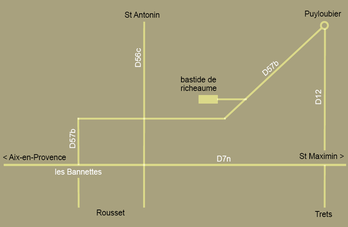
D7n direction St Raphaël, St Maximin (about 7,5km)
at «les Bannettes», take the D57b on your left, direction St Antonin then Puyloubier (about 5km)
the bastide de Richeaume is indicated on your left, 3km before entering Puyloubier
D9 direction Aix-en-Provence
follow Aix-en-Provence then Nice
exit n°32 - Fuveau, Trets
D7n direction St Raphaël, St Maximin (about 7,5km)
at «les Bannettes», take the D57b on your left, direction St Antonin then Puyloubier (about 5km)
the bastide de Richeaume is indicated on your left, 3km before entering Puyloubier
other easy ways to find us:mappy michelin
GPS lat 43.509241 / long 5.647159
Google Earth 43°30’29.00" N / 5°38’54.06" E
from Aix-en-Provence TGV trainstation / Marignane airport:
other easy ways to find us: